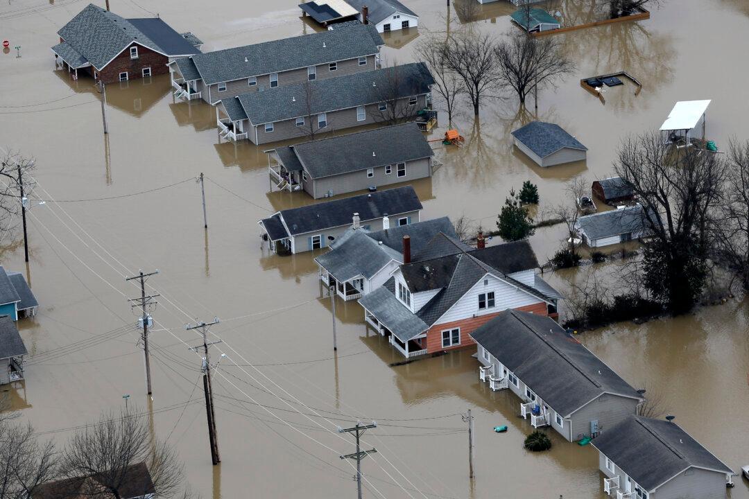
ST. LOUIS—Officials closed a major interstate highway south of St. Louis on Thursday morning amid historic flooding that has already left at least 20 people dead.
Interstate 55 near the town of Arnold was entirely closed early Thursday due to floodwaters from the Meramec River. The Missouri Department of Transportation authorities had already rerouted traffic Wednesday night to allow for sandbagging and pumping.
Other connections between St. Louis and adjacent counties already are closed, including I-44 over the Meramec. The closures forced traffic onto other nearby roads, creating gridlock.
The flooding also prompted evacuations in Missouri and Illinois on Wednesday. As swollen rivers and streams pushed to heights not seen in nearly a quarter-century, officials helped residents get to higher ground amid fears that already dire conditions could worsen as floodwaters began spilling over federal levees protecting communities and farmland.
In Eureka, southwest of St. Louis, firefighters and their boats have been in high demand since Tuesday, accounting for roughly four dozen rescues of people in their homes, businesses or vehicles. Television news footage showed at least one home there drifting in the swollen river Wednesday, when firefighters rescued by boat a man and a dog as floodwaters lapped at the eaves of the house roof on which they'd been trapped for a night.
“Our crews are getting dispatched to another rescue now,” Scott Barthelmass, a Eureka Fire Protection District spokesman, said mid-afternoon Wednesday as the swollen Meramec River there was cresting. “I think you’re seeing people who are desperate or impatient, putting themselves in predicaments.”
The U.S. Army Corps of Engineers announced Wednesday that nine levees had been topped by water. Most of those earthen barriers were meant to protect farmland rather than populated areas and another was along now-deserted, manmade Chouteau Island near St. Louis on the Illinois side of the Mississippi River.
Nearly a dozen other levees considered at risk for “possible significant distress,” were holding, but people were moving out just in case. Michael Pennise, mayor of the St. Louis suburb of Valley Park, ordered mandatory evacuations for 350 to 400 homes and dozens of businesses in the section of town near the fast-rising Meramec River.
At least 20 deaths over several days in Missouri and Illinois were blamed on flooding, mostly involving vehicles that drove onto swamped roadways, and at least two people were still missing Wednesday.
And search teams went out for a third day in hopes of finding a country music singer from Arkansas who disappeared while duck hunting in a flooded area in northern Oklahoma. The floodwaters there also destroyed a leftover film set used in the 2003 remake of “Where the Red Fern Grows.”
A 24-mile stretch of Interstate 44 was closed Wednesday at Valley Park southwest of St. Louis due to Meramec River flooding
Missouri Gov. Jay Nixon has activated the National Guard to assist with security in evacuated areas and to help keep road closure sites clear.
Valley Park City Attorney Tim Engelmeyer called the governor’s office to send troops to help in the evacuated area of the about 7,000-person town. He was also watching computer projections of the crest — expected to be about 3 feet higher than the record of 40 feet on Thursday — knowing that an unexpected upgrade could be enough to send water over the levee.


