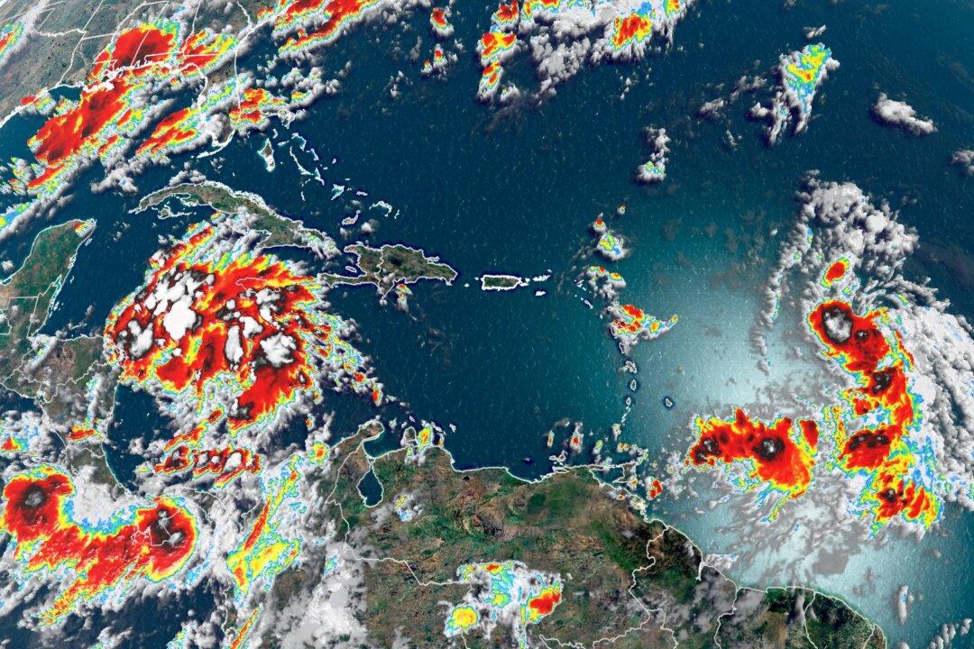
Gulf Coast residents need to pay attention as not one, but two tropical systems could impact the area in the coming days.
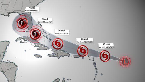
The first system to watch is Tropical Depression Thirteen (TD-13), which is about 800 miles east of the northern Leeward Island. Tropical storm watches have been issued for St. Maarten, Antigua, Barbuda, St. Kitts, Nevis, Anguilla, Saba, and St. Eustatius. Additional watches may be issued as the storm approaches more areas in the next few days.
The second system, Tropical Depression Fourteen (TD-14), is about 200 miles east of the Honduras/Nicaragua border. A tropical storm watch has been issued for portions of Honduras.
This storm is expected to become better organized later Thursday, meaning an upgrade to tropical storm is likely to occur in the next 24 hours.
“Regardless of development, this disturbance will likely produce heavy rains across a large portion of Central America and southeastern Mexico late this week and this weekend,” the National Hurricane Center says.
An Extra Focus on the Gulf of Mexico
Interestingly, TD-13 and TD-14 are both headed to the Gulf of Mexico. The next two names on the list are Laura and Marco. Which depression gets Laura, and which one gets Marco depends only on which storm develops faster.“The longer-term forecast for TD13 looks to be complicated by the presence of another tropical system [TD 14] in the Gulf of Mexico next week,” said Brandon Miller, CNN meteorologist. “Another tropical system spinning in the Gulf will make the forecast track less certain, as tropical storms and hurricanes in close range of each other can alter the winds in the atmosphere and influence each others’ tracks.”
So have we ever had two tropical storm strength systems simultaneously in the Gulf of Mexico before?
It has been 60 years since it has happened, said tropical researcher Phil Klotzbach. June 18, 1959, to be exact.
“On that date, we had an unnamed tropical storm (e.g., added after the season) and Beulah,” Klotzbach said. “We have never had two hurricanes in the Gulf of Mexico simultaneously.”
Weeks Away From Peak of Hurricane Season
TD-13 and TD-14 are both expected to become tropical storms in the next few days. When that happens, they would be the fastest 12th and 13th storms to form, breaking additional records for most storms this early in the season. To have had so many named storms this far before the peak is unprecedented. What’s more concerning is that 85 percent of major hurricanes (Category 3 and above) occur after Aug. 20.“We typically do not have 11 named storms until November 23, across the Atlantic Ocean,” said Haley Brink, CNN meteorologist. “Come peak hurricane season in September, the prevailing tropical storm tracks increase across the Gulf of Mexico and the Caribbean, in addition to storm formation originating off the coast of Africa.”
Above average sea surface temperatures are providing the necessary fuel for the development of tropical cyclone formations. An enhanced La Niña Watch was also issued last week, which could also contribute to enhanced hurricane activity.