
Several storms or remnants of storms are persisting in the Atlantic on Sept. 17.
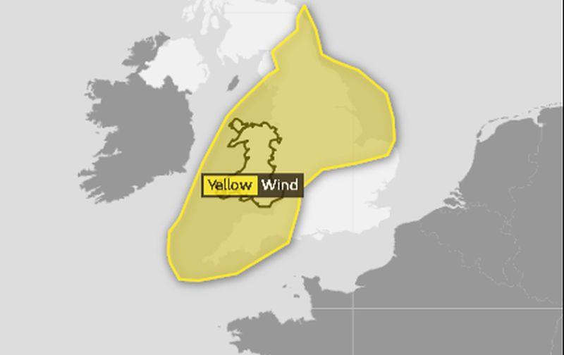
The storm is slated to arrive on Sept. 17 with a yellow “be aware” warning for around 9 p.m. local time. Winds are slated to reach 40 to 50 mph.
“There is not a danger to life, but we are just saying be prepared for it be very windy for a while,” the spokesperson added.
Joyce
Joyce remains a tropical depression in the eastern Atlantic Ocean, and the storm is continuing to lose organization, according to the U.S. National Hurricane Center (NHC).The storm is moving east-southeast at 8 mph and is 285 miles south-southwest of the Azores Islands.
Isaac
The remnants of Tropical Storm Isaac are still moving over the Caribbean near Jamaica.The NHC said that the storm has a 10 percent chance of forming a cyclone in the next 48 hours.
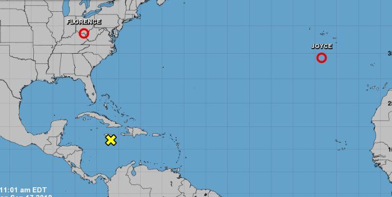
Florence
The remnants of Hurricane Florence are forecast to move north before heading over the northeastern United States on the night of Sept. 17 and Sept. 18.“Flash flood warnings are currently in effect across parts of central North Carolina into far southern Virginia. Flash flood watches are in effect across much of North Carolina, northern South Carolina, portions of Western Virginia, southern and eastern West Virginia, central and western Maryland, central and western Pennsylvania, southern New York and southern New England,” said the NHC.
It added: “Florence is expected to produce heavy to excessive rainfall over the next couple of days. Portions of the Mid Atlantic states west of Interstate 95 into southern New York and southern New England are expected to receive an additional 2 to 4 inches of rain...with isolated maximum amounts of 6 inches possible..”


Friends Read Free